How Does Aerial Photography Work?
Aerial photography is a fascinating technique that allows photographers to capture stunning images from the sky, offering unique perspectives and valuable insights into our world. By taking photographs from an elevated position using a light aircraft or helicopter, aerial photography provides a bird’s eye view of landscapes, architecture, and other features, revealing details that are often hidden from ground-level perspective.
Key Takeaways:
- Aerial photography involves capturing photographs from the air using a light aircraft or helicopter.
- There are two main types of aerial photographs: oblique and vertical. Oblique images provide a wider context and depth, while vertical images focus on topography.
- Aerial photography has been used for over a century and is a valuable source of historic landscape data.
- It is widely utilized in various fields, including archaeology, geography, and environmental studies.
- Aerial photographs can be used to create topographic maps, track land-use changes, study vegetation, and monitor erosion.
Techniques and Equipment Used in Aerial Photography
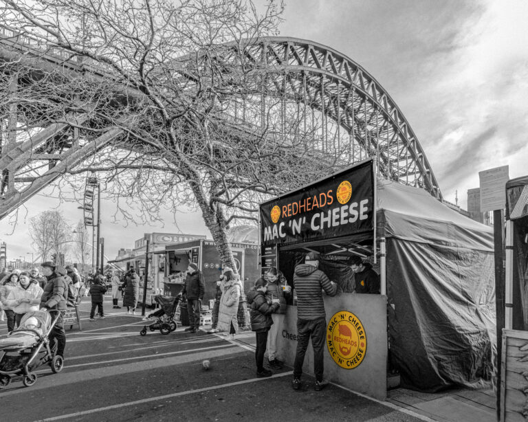
Aerial photography employs a range of techniques and equipment to capture breathtaking images from the air, providing a bird’s-eye view of the world below. These techniques include capturing oblique and vertical photographs, each with its own unique characteristics and applications.
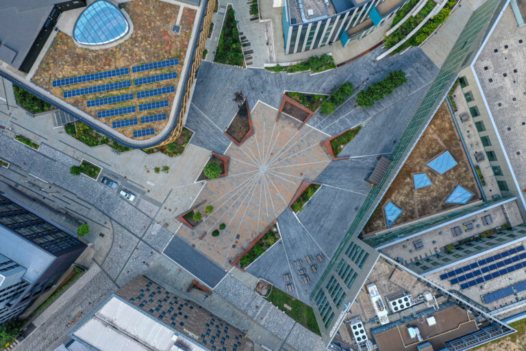
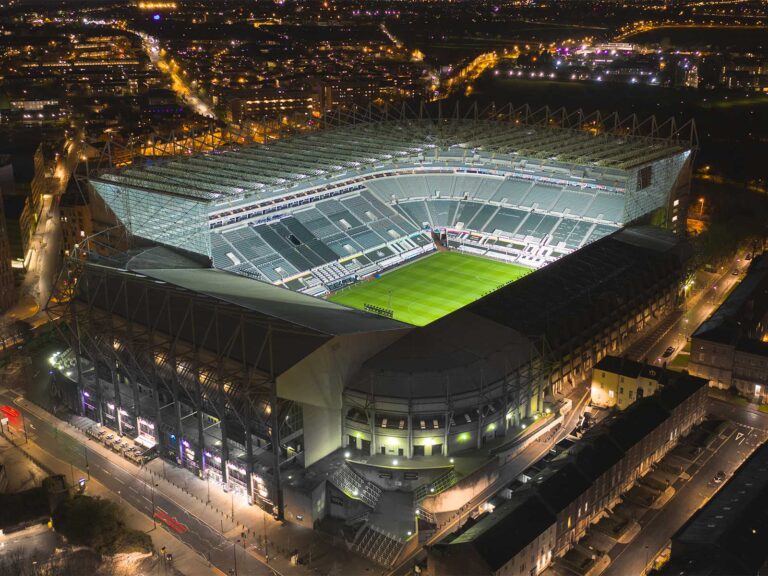
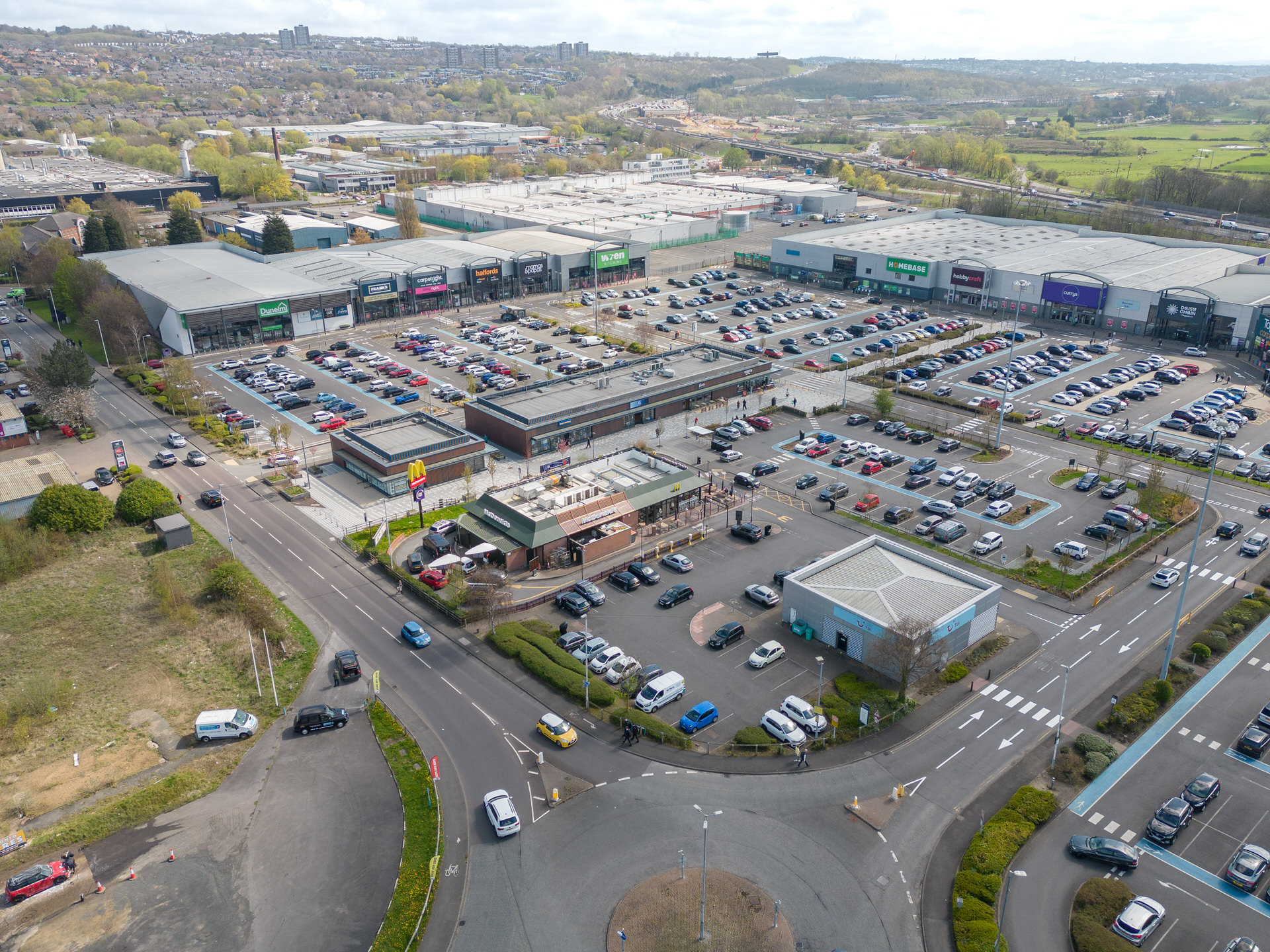
Oblique photography involves taking images from an angle, offering a wider perspective of a feature or landscape. This technique adds depth and context to the photographs, making them particularly useful in urban planning and architecture. Vertical photography, on the other hand, captures images directly from above, focusing on topography and providing accurate measurements. This technique is commonly employed in cartography and land surveying.
To capture these stunning aerial photographs, photographers rely on a variety of equipment. Drones equipped with high-resolution cameras have become increasingly popular due to their versatility and maneuverability. These devices allow photographers to access remote or inaccessible areas, enabling them to capture unique shots. Additionally, traditional aircraft such as helicopters and light aircraft are still used for aerial photography, particularly in commercial or large-scale projects.
Cameras used in aerial photography are specifically designed to withstand the challenges of shooting from the air. They are often equipped with gyroscopic stabilization systems to counteract vibrations and ensure sharp images. Furthermore, some cameras have interchangeable lenses, allowing photographers to adapt to different shooting conditions and objectives. The resulting images can then be processed and corrected for distortion, producing accurate orthophotos that can be used in various industries.
Comparison of Aerial Photography Techniques
| Technique | Characteristics | Applications |
|---|---|---|
| Oblique Photography | Wide-angle perspective, depth | Urban planning, architecture |
| Vertical Photography | Topographic focus, accurate measurements | Cartography, land surveying |
Aerial photography continues to play a crucial role in capturing stunning images and providing valuable data for a wide range of fields. Despite the availability of satellite imagery and other remote sensing methods, aerial photography remains a popular choice due to its ability to capture detailed and high-resolution images from unique angles. Whether it’s for archaeological studies, environmental monitoring, or simply capturing the beauty of our world, aerial photography continues to push the boundaries of visual storytelling.
The Impact and Applications of Aerial Photography
Aerial photography has become an invaluable tool in numerous industries, with its applications ranging from historical research to environmental conservation. In archaeology, aerial photographs allow researchers to uncover hidden features of ancient landscapes, revealing patterns and structures that may not be visible from the ground. The ability to capture images from a bird’s-eye view provides a unique perspective and helps archaeologists identify potential sites for excavation.
Geographers also rely on aerial photography for various purposes. The high-resolution images enable them to map and analyze landforms, such as mountain ranges and river systems, with great accuracy. By studying the landscape changes over time, geographers can better understand processes such as erosion and land-use patterns. Aerial photography is particularly useful in monitoring urban growth and development, aiding in urban planning and infrastructure management.
Furthermore, aerial photography plays a vital role in environmental studies and conservation efforts. By capturing detailed images of ecosystems and remote areas, scientists can assess the health of vegetation, detect changes in land cover, and monitor the impact of human activities on natural habitats. These images provide valuable data for environmental impact assessments and inform conservation strategies to protect threatened species and fragile ecosystems.
Summary:
- Aerial photography is widely used in archaeology, geography, and environmental studies.
- It helps archaeologists discover hidden features and identify potential excavation sites.
- Geographers rely on aerial photography for accurate mapping and analysis of landforms and urban growth.
- In environmental studies, aerial photography aids in monitoring vegetation, land cover changes, and conservation efforts.
| Industry | Applications |
|---|---|
| Archaeology | Uncovering hidden features, identifying excavation sites |
| Geography | Precise mapping, analyzing landforms, monitoring urban growth |
| Environmental Studies | Assessing vegetation health, monitoring land cover changes, informing conservation efforts |
Conclusion
In conclusion, aerial photography offers a captivating way to explore our world from above, enabling us to gain new insights and appreciate the beauty of our surroundings from a different perspective. Aerial photography has been a valuable source of historic landscape data for over a century, providing us with a visual record of our changing environment. By utilizing different techniques and equipment, we can capture oblique and vertical images that serve different purposes.
Oblique photographs give us a wider context of a feature or landscape, offering depth and allowing us to understand the relationships between different elements. On the other hand, vertical photographs provide a top-down view, focusing on topography and enabling us to create accurate maps and track land-use changes over time.
With its applications spanning across fields like archaeology, geography, and environmental studies, aerial photography plays a crucial role in expanding our knowledge and understanding of the world. It allows us to study vegetation patterns, monitor erosion, and track changes in land use. Despite the availability of satellite imagery and other remote sensing methods, aerial photography remains an important tool due to its ability to capture unique perspectives and provide detailed, high-resolution images.
So, whether it is uncovering ancient ruins, mapping expansive landscapes, or studying the impact of human activities on the environment, aerial photography continues to offer unparalleled opportunities for exploration and discovery. From the lens of a camera high above, we are able to see our world in a way that is both awe-inspiring and informative, reminding us of the vastness and complexity of our planet. So why not take to the skies and embark on a journey of visual discovery through the wonders of aerial photography?
FAQ
How does aerial photography work?
Aerial photography involves capturing photographs from the air, usually using a light aircraft or helicopter. Different types of cameras and equipment are used to take oblique and vertical images, which provide different angles and perspectives.
What techniques and equipment are used in aerial photography?
Aerial photography employs various techniques, including capturing oblique and vertical images. Equipment such as cameras, drones, and aircraft are used to capture aerial photographs.
What are the applications of aerial photography?
Aerial photography has numerous applications across different fields. It is used in archaeology, geography, and environmental studies to create topographic maps, monitor land-use changes, study vegetation, and track erosion.
Why is aerial photography still important despite the availability of satellite imagery?
Aerial photography remains vital because it offers unique perspectives and can capture details not visible in satellite imagery. It provides valuable historic landscape data and is widely used in various research and monitoring activities.
Source Links
- https://en.wikipedia.org/wiki/Aerial_photography
- https://www.environmentalscience.org/principles-applications-aerial-photography
- https://www.sciencedirect.com/topics/social-sciences/aerial-photography
- About the Author
- Latest Posts
Garry Bell is the owner and award-winning lead photographer at Elemental Photography, based in Newcastle Upon Tyne, North East of England. With a rich portfolio that spans promotional, aerial, and property photography, as well as 360° virtual tours, Garry and his team offer a comprehensive suite of services that cater to a diverse range of sectors including hotels, holiday homes, and leisure complexes, both in the UK and Europe. Certified by the U.K. Civil Aviation Authority for commercial drone work, Garry leverages the latest technology, including high-quality Sony equipment, to capture stunning visuals. A CAA-approved drone pilot, he embodies a commitment to safety and legality in all operations, ensuring a professional and reliable service.